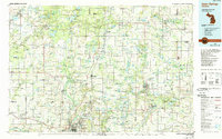
1986 Map of Cedar Springs
USGS Topo · Published 1989About this map
The Muskegon River and Grand River systems anchor this West Michigan landscape, illustrating the region's transition from the northern reaches of Grand Rapids into the timber and agricultural lands of the Manistee National Forest. This 1980s era study shows a complex network of glacial lakes and river valleys, including the Flat River corridor which connects industrial hubs like Belding and Greenville. The transit infrastructure of the late 20th century is fully realized here, with Us-131 bisecting the region alongside the historic routes of the C & O RR and GTW RR.
Find a feature on this map
150 named features on this map. Tap any name to fly to it.
Don’t see what you’re looking for? This feature index may not catch every label — zoom into the map to look around manually.
Map Details
Editions of this 1986 Cedar Springs Map
This is the sole edition of this map. No revisions or reprints were ever made.
Other maps of this area

1914 · Grand Rapids
USGS Topo · 1:62,500

1916 · Mount Pleasant
USGS Topo · 1:62,500

1916 · Ionia
USGS Topo · 1:62,500

1918 · Cedar Springs
USGS Topo · 1:62,500

1918 · Ionia
USGS Topo · 1:62,500

1918 · Lowell
USGS Topo · 1:62,500

1919 · Mount Pleasant
USGS Topo · 1:62,500

1929 · Holland
USGS Topo · 1:62,500

1930 · Muskegon
USGS Topo · 1:62,500

1931 · Walkerville SE
USGS Topo · 1:31,680