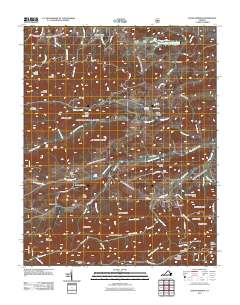
2011 Map of Cedar Springs
USGS Topo · Published 2011About this map
Cedar Springs and Fairview anchor this upland landscape where the South Fork and Cripple Creek carve through a complex network of ridges and hollows. The terrain is defined by prominent elevations such as Buchanan Mountain, Snake Den Mountain, and Glade Mountain, the latter of which features the Glade Mountain Shelter along its slopes. These natural barriers are pierced by numerous branches and creeks, creating secluded areas like Dark Hollow and Heldreth Hollow.
Find a feature on this map
69 named features on this map. Tap any name to fly to it.
Don’t see what you’re looking for? This feature index may not catch every label — zoom into the map to look around manually.
Map Details
Editions of this 2011 Cedar Springs Map
This is the sole edition of this map. No revisions or reprints were ever made.
Other maps of this area

1889 · Wytheville
USGS Topo · 1:125,000

1892 · Wytheville
USGS Topo · 1:125,000

1930 · Speedwell
USGS Topo · 1:62,500

1930 · Independence
USGS Topo · 1:48,000

1931 · Rural Retreat
USGS Topo · 1:48,000

1933 · Independence
USGS Topo · 1:62,500

1935 · Nebo
USGS Topo · 1:24,000

1935 · Mouth of Wilson
USGS Topo · 1:48,000

1935 · Cedar Springs
USGS Topo · 1:24,000
1935 · Trout Dale
USGS Topo · 1:24,000