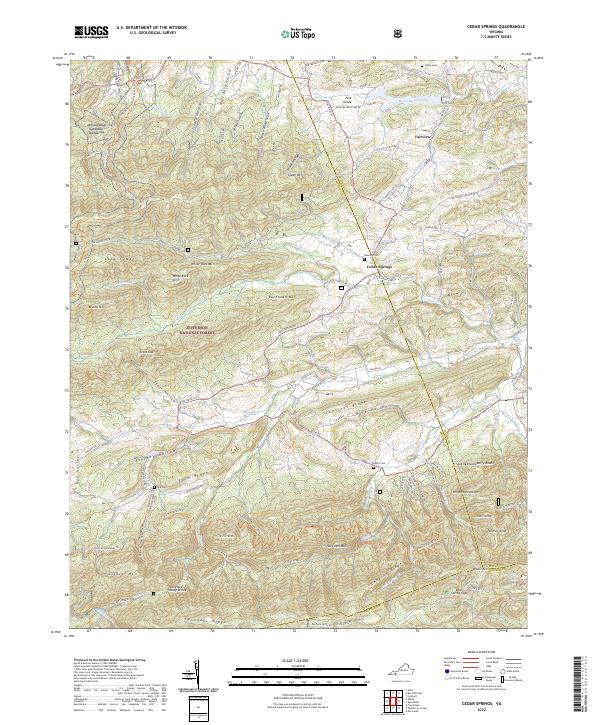
2022 Map of Cedar Springs
USGS Topo · Published 2022About this map
Cedar Springs sits at the intersection of mountain ridges and watercourses where Smyth and Wythe counties meet. This survey shows the agricultural and recreational landscape of the modern era, anchored by the waters of Rural Retreat Lake and the long course of Cripple Creek. The map is characterized by a dense network of family-named gaps and hollows, including Scott Hollow and Dark Hollow, which define the local geography. Significant portions of the land are protected within the Jefferson National Forest, where the Appalachian National Scenic Trail winds across the high ground of Glade Mountain. Genealogists will find several burial sites including Keesling Cemetery and Steffy Cemetery, while the presence of White Rock Furnace Road hints at the industrial heritage of this corner of the Blue Ridge.
Find a feature on this map
64 named features on this map. Tap any name to fly to it.
Don’t see what you’re looking for? This feature index may not catch every label — zoom into the map to look around manually.
Map Details
Editions of this 2022 Cedar Springs Map
This is the sole edition of this map. No revisions or reprints were ever made.
Other maps of this area

1889 · Wytheville
USGS Topo · 1:125,000

1892 · Wytheville
USGS Topo · 1:125,000

1930 · Speedwell
USGS Topo · 1:62,500

1930 · Independence
USGS Topo · 1:48,000

1931 · Rural Retreat
USGS Topo · 1:48,000

1933 · Independence
USGS Topo · 1:62,500

1935 · Nebo
USGS Topo · 1:24,000

1935 · Mouth of Wilson
USGS Topo · 1:48,000

1935 · Cedar Springs
USGS Topo · 1:24,000
1935 · Trout Dale
USGS Topo · 1:24,000