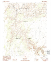
1985 Map of Cedar Tree Bench
USGS Topo · Published 1985About this map
Navajo Indian Reservation lands meet the rising waters of Lake Powell in this mid-1980s topographical study. The landscape is defined by the dramatic descent from the Rainbow Plateau into complex drainage systems like Chaol Canyon and Navajo Creek. Much of the northern area is managed within the Glen Canyon National Recreation Area, showing a transition from high desert benches to submerged canyon floors.
Find a feature on this map
21 named features on this map. Tap any name to fly to it.
Don’t see what you’re looking for? This feature index may not catch every label — zoom into the map to look around manually.
Map Details
Editions of this 1985 Cedar Tree Bench Map
This is the sole edition of this map. No revisions or reprints were ever made.
Other maps of this area

1886 · Echo Cliffs
USGS Topo · 1:250,000

1891 · Echo Cliffs
USGS Topo · 1:250,000

1954 · Leche-E Rock
USGS Topo · 1:62,500

1954 · Navajo Creek
USGS Topo · 1:62,500

1956 · Marble Canyon
USGS Topo · 1:250,000

1959 · Marble Canyon
USGS Topo · 1:250,000

1961 · Marble Canyon
USGS Topo · 1:250,000
1981 · Horsethief Mesa
USGS Topo · 1:24,000
1982 · White Hill
USGS Topo · 1:24,000
1982 · Many Ghosts Hill
USGS Topo · 1:24,000