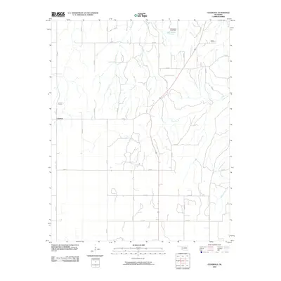
2010 Map of Cedardale
USGS Topo · Published 2010About this map
Cedardale serves as the primary landmark in this rural Oklahoma landscape, characterized by the branching drainage basins of Griever Creek and Main Creek. The topography is defined by the section-line road grid, including n2250 RD and e0500 RD, which organizes the agricultural and ranching land. Significant for local historians and genealogists, the map identifies both the Cedardale Cemetery and Liberty Cemetery, providing vital touchpoints for family research in this part of Woodward County. Water management is a visible priority in the northern reaches, evidenced by the Hall Number 3 Lake Dam and its accompanying reservoir, Hall Number 3 Lake. The map illustrates a quiet, late-20th-century transition where traditional rural roads like d2310 RD intersect with the more prominent state and regional corridors, maintaining the sparse settlement pattern typical of the western Oklahoma plains.
Find a feature on this map
32 named features on this map. Tap any name to fly to it.
Don’t see what you’re looking for? This feature index may not catch every label — zoom into the map to look around manually.
Map Details
Editions of this 2010 Cedardale Map
This is the sole edition of this map. No revisions or reprints were ever made.
Other maps of this area

1955 · Woodward
USGS Topo · 1:250,000

1958 · Woodward
USGS Topo · 1:250,000

1969 · Mooreland SE
USGS Topo · 1:24,000

1969 · Phroso
USGS Topo · 1:24,000

1969 · Belva
USGS Topo · 1:24,000

1969 · Quinlan
USGS Topo · 1:24,000

1969 · Cedardale
USGS Topo · 1:24,000

1969 · Togo
USGS Topo · 1:24,000

1969 · Mutual NE
USGS Topo · 1:24,000

1972 · Seiling
USGS Topo · 1:24,000