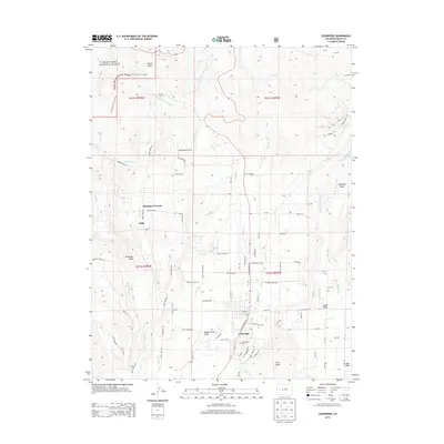
2013 Map of Cedaredge
USGS Topo · Published 2013About this map
Cedaredge serves as the focal point of this 2013 survey, situated at the base of the massive volcanic plateau of Grand Mesa. The landscape is defined by its sophisticated irrigation network, necessary for the region's agricultural vitality. An intricate system of ditches and aqueducts, including the Orchard City Aqueduct, Granby Ditch, and Big Ditch, divert water from the high mesas to the orchards and fields below. This reliance on water management is evident in the naming of local features like Cedar Mesa Ditch and Alfalfa Ditch.
Find a feature on this map
87 named features on this map. Tap any name to fly to it.
Don’t see what you’re looking for? This feature index may not catch every label — zoom into the map to look around manually.
Map Details
Editions of this 2013 Cedaredge Map
This is the sole edition of this map. No revisions or reprints were ever made.
Other maps of this area

1955 · Grand Mesa
USGS Topo · 1:24,000

1955 · Lazear
USGS Topo · 1:24,000

1955 · Skyway
USGS Topo · 1:24,000

1956 · Montrose
USGS Topo · 1:250,000

1956 · Moab
USGS Topo · 1:250,000

1956 · Grand Junction
USGS Topo · 1:250,000

1957 · Leadville
USGS Topo · 1:250,000

1959 · Grand Junction
USGS Topo · 1:250,000

1959 · Moab
USGS Topo · 1:250,000

1959 · Leadville
USGS Topo · 1:250,000