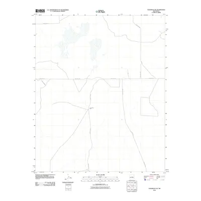
2010 Map of Cedarvale NE
USGS Topo · Published 2010About this map
Going Thing Ranch stands as a primary landmark in this section of Torrance County, situated where County Rd-C033 intersects with routes heading toward the southeast. The landscape is defined by the high-desert character of central New Mexico, featuring several large ephemeral basins and playas that suggest a complex local drainage system during the rainy season. A network of rural arteries, including Pinos Wells Rd and County Rd-C032, provides the essential infrastructure for ranching operations in this open country. The presence of these named ranching features and numbered county roads reflects the enduring importance of large land holdings and remote navigation in this region at the start of the 21st century.
Find a feature on this map
7 named features on this map. Tap any name to fly to it.
Don’t see what you’re looking for? This feature index may not catch every label — zoom into the map to look around manually.
Map Details
Editions of this 2010 Cedarvale NE Map
This is the sole edition of this map. No revisions or reprints were ever made.
Other maps of this area

1954 · Fort Sumner
USGS Topo · 1:250,000

1958 · Fort Sumner
USGS Topo · 1:250,000

1978 · Negra SW
USGS Topo · 1:24,000

1978 · Negra SE
USGS Topo · 1:24,000

1978 · Dunlap Ranch
USGS Topo · 1:24,000

1980 · Corona
USGS Topo · 1:100,000

1981 · Pino Mountain
USGS Topo · 1:24,000

1981 · Camaleon Draw West
USGS Topo · 1:24,000
1981 · Duran
USGS Topo · 1:24,000
1981 · Cedarvale NE
USGS Topo · 1:24,000