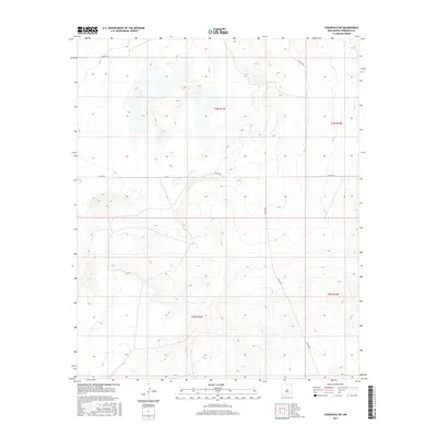
2017 Map of Cedarvale NE
USGS Topo · Published 2017About this map
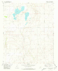
Arid basin terrain and ephemeral wetlands characterize this section of the High Plains, where elevation contours reveal a series of shallow depressions and rising ridges. The landscape is structured by the Public Land Survey System, evidenced by the township and range divisions of t3n r13e and t3n r14e to the north, and t2n r13e and t2n r14e to the south. This rectilinear grid defines property and land use in an area where water is a primary shaper of the land's utility. A network of county roads provides the essential infrastructure for this rural expanse, including the east-west passage of Co RD c014 and the diagonal route of Co RD c063. The topography is marked by localized basins that likely collect seasonal runoff, creating a distinct pattern of drainage across the New Mexico landscape.
Find a feature on this map
8 named features on this map. Tap any name to fly to it.
Don’t see what you’re looking for? This feature index may not catch every label — zoom into the map to look around manually.
Map Details
Editions of this 2017 Cedarvale NE Map
This is the sole edition of this map. No revisions or reprints were ever made.
Other maps of this area

1954 · Fort Sumner
USGS Topo · 1:250,000

1958 · Fort Sumner
USGS Topo · 1:250,000
1978 · Negra SW
USGS Topo · 1:24,000
1978 · Negra SE
USGS Topo · 1:24,000
1978 · Dunlap Ranch
USGS Topo · 1:24,000
1980 · Corona
USGS Topo · 1:100,000
1981 · Pino Mountain
USGS Topo · 1:24,000
1981 · Camaleon Draw West
USGS Topo · 1:24,000
1981 · Duran
USGS Topo · 1:24,000
1981 · Cedarvale NE
USGS Topo · 1:24,000