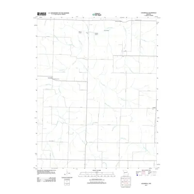
2011 Map of Cedarville
USGS Topo · Published 2011About this map
Cedarville and the Horse Creek Post Office serve as the central landmarks in this rural Dade County landscape, where the terrain is defined by a dense network of watercourses and naming traditions. The geography is characterized by numerous branches and creeks, such as Goose Creek, Keller Branch, and Greaser Creek, which carve through local hollows like Spring Hollow and Carlo Hollow. This 2011 survey reveals a persistent rural structure, where small settlements like Omer and Arcola are connected by a grid of county roads and historic crossings such as Brown Ford and Noffsinger Bridge. Genealogists will find significant value in the documentation of family-named sites, including the Amos Cemetery, Omer Cemetery, and Noffsinger Cemetery, which are preserved alongside the winding path of Cedar Creek.
Find a feature on this map
53 named features on this map. Tap any name to fly to it.
Don’t see what you’re looking for? This feature index may not catch every label — zoom into the map to look around manually.
Map Details
Editions of this 2011 Cedarville Map
This is the sole edition of this map. No revisions or reprints were ever made.
Other maps of this area

1886 · Nevada
USGS Topo · 1:125,000

1886 · Stockton
USGS Topo · 1:125,000

1886 · Greenfield
USGS Topo · 1:125,000

1886 · Carthage
USGS Topo · 1:125,000

1888 · Greenfield
USGS Topo · 1:125,000

1894 · Nevada
USGS Topo · 1:125,000

1894 · Carthage
USGS Topo · 1:125,000

1947 · Joplin
USGS Topo · 1:250,000

1949 · Joplin
USGS Topo · 1:250,000

1954 · Springfield
USGS Topo · 1:250,000