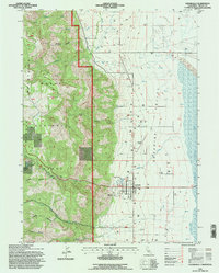
1993 Map of Cedarville
USGS Topo · Published 1996About this map
Cedarville serves as the primary hub in this eastern Modoc County landscape, where the dramatic elevation drop of the Warner Mountains meets the flat expanse of Surprise Valley. The township's grid is clearly defined, including the Cedarville Rancheria and the local Cem to the north. To the east, the terrain transitions into the bed of Middle Alkali Lake, an area marked by wide Alkali Flats and seasonal water features. Within the Modoc National Forest, numerous steep drainages such as Soldier Creek, Smalls Canyon, and Simpson Canyon carve through the western high ground. The map details the rural infrastructure of the early 1990s, from the Cedarville Airport and various Stock Ponds to the remote track known as Forty-nine heading toward the state line.
Find a feature on this map
29 named features on this map. Tap any name to fly to it.
Don’t see what you’re looking for? This feature index may not catch every label — zoom into the map to look around manually.
Map Details
Editions of this 1993 Cedarville Map
This is the sole edition of this map. No revisions or reprints were ever made.
Other maps of this area

1886 · Alturas
USGS Topo · 1:250,000

1892 · Alturas
USGS Topo · 1:250,000

1954 · Alturas
USGS Topo · 1:250,000

1958 · Alturas
USGS Topo · 1:250,000

1962 · Alturas
USGS Topo · 1:250,000

1962 · Davis Creek
USGS Topo · 1:62,500

1962 · Cedarville
USGS Topo · 1:62,500

1963 · Warren Peak
USGS Topo · 1:24,000
1963 · Hansen Island
USGS Topo · 1:24,000

1963 · Shields Creek
USGS Topo · 1:24,000