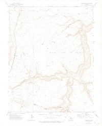
1970 Map of Cedarwood
USGS Topo · Published 1974About this map
The Huerfano River and Cucharas River converge amidst a deeply dissected landscape along the Pueblo and Huerfano County border. This 1970 field check documents a rural ranching and infrastructure corridor defined by the parallel tracks of the Colorado and Southern and the Denver and Rio Grande Western railroads. The small settlement of Cedarwood sits near the head of Cedarwood Canyon, serving as a focal point for a region reliant on scattered water sources like Bustos Spring and Edmondson Spring. Large land grants are represented by the Vigil and St Vrain and Vigil and St Vrain No 6 designations, while the presence of Numerous wells, including Well No 9 and Well No 30, points to the vital importance of groundwater management in this arid terrain.
Find a feature on this map
35 named features on this map. Tap any name to fly to it.
Don’t see what you’re looking for? This feature index may not catch every label — zoom into the map to look around manually.
Map Details
Editions of this 1970 Cedarwood Map
This is the sole edition of this map. No revisions or reprints were ever made.
Other maps of this area

1891 · Walsenburg
USGS Topo · 1:125,000

1891 · Pueblo
USGS Topo · 1:125,000

1891 · Nepesta
USGS Topo · 1:125,000

1891 · Apishapa
USGS Topo · 1:125,000

1893 · Nepesta
USGS Topo · 1:125,000

1893 · Apishapa
USGS Topo · 1:125,000

1894 · Walsenburg
USGS Topo · 1:125,000

1894 · Pueblo
USGS Topo · 1:125,000

1896 · Pueblo
USGS Topo · 1:125,000

1897 · Pueblo
USGS Topo · 1:125,000