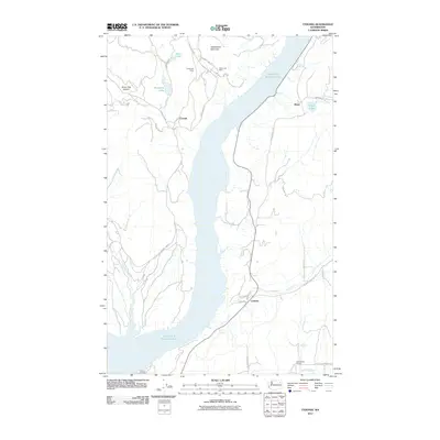
2011 Map of Cedonia
USGS Topo · Published 2011About this map
Franklin D Roosevelt Lake dominates this portion of Stevens County, carving a wide path through the terrain as it follows the original course of the Columbia River. This early 21st-century landscape reveals the remote character of the region, where mining interests like the Longstreet Mine and Silver Leaf Mine were established near the slopes of Rattlesnake Mountain. The map details small rural clusters and community landmarks such as Cedonia, Bissel, and the Greenwood Grange, connected by a network of winding roads including County Hwy 85 and Silver Creek Rd. West of the lake, the topography becomes more dramatic with features like Stray Dog Canyon and Nez Perce Creek flowing through the hills, illustrating the geographic isolation of settlements like Covada.
Find a feature on this map
29 named features on this map. Tap any name to fly to it.
Don’t see what you’re looking for? This feature index may not catch every label — zoom into the map to look around manually.
Map Details
Editions of this 2011 Cedonia Map
This is the sole edition of this map. No revisions or reprints were ever made.
Other maps of this area

1948 · Hunters
USGS Topo · 1:62,500

1948 · Wilmont Creek
USGS Topo · 1:62,500

1950 · Wilmont Creek
USGS Topo · 1:62,500

1950 · Hunters
USGS Topo · 1:62,500

1950 · Inchelium
USGS Topo · 1:62,500

1952 · Twin Lakes
USGS Topo · 1:62,500

1954 · Okanogan
USGS Topo · 1:250,000

1956 · Wilmont Creek
USGS Topo · 1:62,500

1958 · Okanogan
USGS Topo · 1:250,000

1984 · Nespelem
USGS Topo · 1:100,000