
1950 Map of Wilmont Creek
USGS Topo · Published 1950About this map
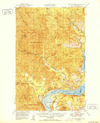
The Colville Indian Reservation dominates this mid-century survey, showcasing a landscape of high ridges and deep canyons bordering the recently formed Franklin D Roosevelt Lake. Following the completion of the Grand Coulee Dam, the Columbia River corridor was transformed into a massive reservoir, here part of the Coulee Dam National Recreational Area. Small settlements like Kewa and Rogers Bar sit above the new shoreline, accompanied by local institutions such as Kewa Sch and Rogers Bar Sch.
Find a feature on this map
47 named features on this map. Tap any name to fly to it.
Don’t see what you’re looking for? This feature index may not catch every label — zoom into the map to look around manually.
Map Details
Editions of this 1950 Wilmont Creek Map
2 editions found
Other maps of this area

1948 · Hunters
USGS Topo · 1:62,500

1948 · Wilbur
USGS Topo · 1:62,500

1948 · Wilmont Creek
USGS Topo · 1:62,500

1948 · Lincoln
USGS Topo · 1:62,500

1948 · Turtle Lake
USGS Topo · 1:62,500

1950 · Lincoln
USGS Topo · 1:62,500

1950 · Turtle Lake
USGS Topo · 1:62,500

1950 · Wilbur
USGS Topo · 1:62,500

1950 · Hunters
USGS Topo · 1:62,500

1950 · Inchelium
USGS Topo · 1:62,500