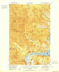
1950 Map of Wilmont Creek
USGS Topo · Published 1950About this map
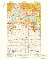
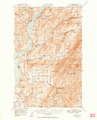
Colville Indian Reservation lands dominate this mid-century landscape, which centers on the steep drainage basins of Wilmont Creek and its many tributaries. The area is defined by the significant hydrological change brought by the impoundment of the Columbia River, which forms the eastern and southern boundaries within the Coulee Dam National Recreational Area. Small rural community hubs like Kewa serve the interior, evidenced by the Kewa Sch and Kewa Cem located along the northern reach of the creek. Near the southern river bend, the topography descends toward Ninemile Flat and the Ninemile Falls, while the Spokane Indian Reservation occupies the southeast corner. The map documents a rugged transitional era where traditional landmarks like Rima Flat and Gold Mtn coexist with the newly established reservoir shoreline and settlements like Rogers Bar.
Find a feature on this map
48 named features on this map. Tap any name to fly to it.
Don’t see what you’re looking for? This feature index may not catch every label — zoom into the map to look around manually.
Map Details
Editions of this 1950 Wilmont Creek Map
2 editions found
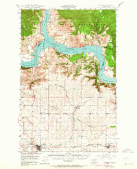
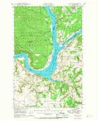
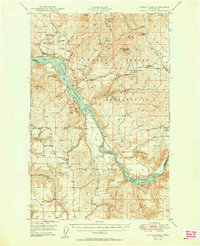
Other maps of this area

1948 · Hunters
USGS Topo · 1:62,500
1948 · Wilbur
USGS Topo · 1:62,500

1948 · Wilmont Creek
USGS Topo · 1:62,500
1948 · Lincoln
USGS Topo · 1:62,500

1948 · Turtle Lake
USGS Topo · 1:62,500

1950 · Lincoln
USGS Topo · 1:62,500
1950 · Turtle Lake
USGS Topo · 1:62,500

1950 · Wilmont Creek
USGS Topo · 1:62,500
1950 · Wilbur
USGS Topo · 1:62,500
1950 · Hunters
USGS Topo · 1:62,500