
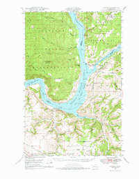
1948 Map of Lincoln
USGS Topo · Published 1968About this map
Franklin D Roosevelt Lake dominates the center of this 1940s landscape, illustrating the transformation of the upper Columbia River following the completion of the Grand Coulee Dam. Along the southern banks, the settlement of Lincoln sits near an Air Strip and the winding Hawk Creek, while to the east, the confluence with the Spokane River is guarded by the site of Fort Spokane. The map captures a moment of transition where established highland agriculture on Bachelor Prairie and Swede Flats meets the newly created shoreline of the Coulee Dam National Recreational Area. North of the water, the Colville Indian Reservation contains landmarks like Johnny George Mtn and the remote Rothlisburg Sch. Small rural centers such as Enterprise and Miles serve the surrounding Enterprise Valley, connected by the historic Spokane Trail Road.
Find a feature on this map
50 named features on this map. Tap any name to fly to it.
Don’t see what you’re looking for? This feature index may not catch every label — zoom into the map to look around manually.
Map Details
Editions of this 1948 Lincoln Map
2 editions found
Other maps of this area

1948 · Hunters
USGS Topo · 1:62,500

1948 · Wilbur
USGS Topo · 1:62,500

1948 · Wilmont Creek
USGS Topo · 1:62,500

1948 · Turtle Lake
USGS Topo · 1:62,500

1950 · Lincoln
USGS Topo · 1:62,500

1950 · Turtle Lake
USGS Topo · 1:62,500

1950 · Wilmont Creek
USGS Topo · 1:62,500

1950 · Wilbur
USGS Topo · 1:62,500

1950 · Hunters
USGS Topo · 1:62,500

1952 · Keller
USGS Topo · 1:62,500