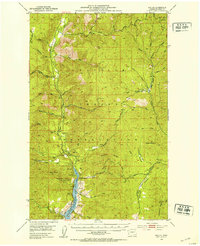
1952 Map of Keller
USGS Topo · Published 1953About this map
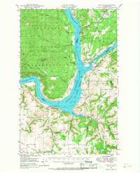
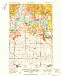
Keller sits at the heart of this mid-century survey, positioned along the Sanpoil River within the expansive Colville Indian Reservation. The landscape is defined by the significant rise of Mount Tolman and the high ridges of Watson Ridge and Whitestone Ridge, punctuated by a network of mining activity. To the south, the recently formed Franklin D Roosevelt Lake backfills the river valley, a major feature of the Coulee Dam National Recreational Area. Geologists and local historians will find several extractive sites documented, including the Shamrock Mine, Keno Mine, and Pacific Mutual Mine, alongside the gravel pits that supported early infrastructure. The map also records essential community landmarks like the Cem near the river and the Gaging Sta monitoring the flow through this mountainous Ferry County terrain.
Find a feature on this map
48 named features on this map. Tap any name to fly to it.
Don’t see what you’re looking for? This feature index may not catch every label — zoom into the map to look around manually.
Map Details
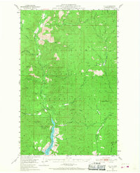
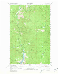
Editions of this 1952 Keller Map
3 editions found
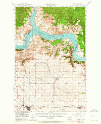
Other maps of this area

1948 · Grand Coulee Dam
USGS Topo · 1:62,500
1948 · Wilbur
USGS Topo · 1:62,500

1948 · Wilmont Creek
USGS Topo · 1:62,500
1948 · Lincoln
USGS Topo · 1:62,500

1950 · Lincoln
USGS Topo · 1:62,500

1950 · Wilmont Creek
USGS Topo · 1:62,500
1950 · Wilbur
USGS Topo · 1:62,500

1950 · Grand Coulee Dam
USGS Topo · 1:62,500

1950 · Nespelem
USGS Topo · 1:62,500
1952 · Twin Lakes
USGS Topo · 1:62,500