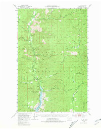
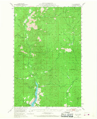
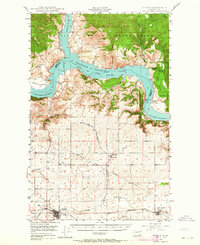
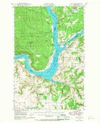
1952 Map of Keller
USGS Topo · Published 1981About this map
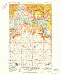
The Colville Indian Reservation provides the primary landscape for this 1952 study, where the Sanpoil River flows southward toward its confluence with the massive Franklin D. Roosevelt Lake. The settlement of Keller serves as a central hub, situated near a Cem and several significant mining operations that once drove the local economy. Resource extraction is evident throughout the terrain, from the Shamrock Mine and Meadow Creek Mine in the north to the Consolidated Mines and Pacific Mutual Mines further south.
Find a feature on this map
48 named features on this map. Tap any name to fly to it.
Don’t see what you’re looking for? This feature index may not catch every label — zoom into the map to look around manually.
Map Details
Editions of this 1952 Keller Map
3 editions found
Other maps of this area

1948 · Grand Coulee Dam
USGS Topo · 1:62,500
1948 · Wilbur
USGS Topo · 1:62,500

1948 · Wilmont Creek
USGS Topo · 1:62,500
1948 · Lincoln
USGS Topo · 1:62,500

1950 · Lincoln
USGS Topo · 1:62,500

1950 · Wilmont Creek
USGS Topo · 1:62,500
1950 · Wilbur
USGS Topo · 1:62,500

1950 · Grand Coulee Dam
USGS Topo · 1:62,500

1950 · Nespelem
USGS Topo · 1:62,500
1952 · Keller
USGS Topo · 1:62,500