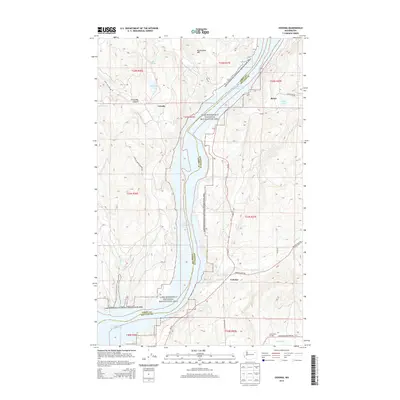
2014 Map of Cedonia
USGS Topo · Published 2014About this map
Franklin D Roosevelt Lake dominates the central corridor of this landscape, defining the boundary between the Colville Indian Reservation to the west and the rural reaches of Stevens County to the east. The terrain is a complex of sharp drainages and high points, including Rattlesnake Mtn and the appropriately named Stray Dog Canyon. Settlement is concentrated along the eastern shore and upland benches, where the small community of Cedonia serves as a local hub near the mouth of Harvey Cr. Further north, Bissel sits along the roadway that traces the lake's edge, while Hunters Landing provides a point of access to the water at the southern end of the sheet. The inclusion of the Greenwood Grange reflects the area's agricultural foundations, showing how social and civic life was organized in this corner of Washington even as much of the land is preserved within the Lake Roosevelt National Recreation Area.
Find a feature on this map
32 named features on this map. Tap any name to fly to it.
Don’t see what you’re looking for? This feature index may not catch every label — zoom into the map to look around manually.
Map Details
Editions of this 2014 Cedonia Map
This is the sole edition of this map. No revisions or reprints were ever made.
Other maps of this area

1948 · Hunters
USGS Topo · 1:62,500

1948 · Wilmont Creek
USGS Topo · 1:62,500

1950 · Wilmont Creek
USGS Topo · 1:62,500

1950 · Hunters
USGS Topo · 1:62,500

1950 · Inchelium
USGS Topo · 1:62,500

1952 · Twin Lakes
USGS Topo · 1:62,500

1954 · Okanogan
USGS Topo · 1:250,000

1956 · Wilmont Creek
USGS Topo · 1:62,500

1958 · Okanogan
USGS Topo · 1:250,000

1984 · Nespelem
USGS Topo · 1:100,000