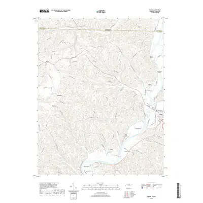
2019 Map of Celina
USGS Topo · Published 2019About this map
The Cumberland River and Obey River converge near the town of Celina, anchoring a landscape of deep valleys and prominent ridges along the Kentucky-Tennessee border. This survey documents the rural character of Clay County, where small settlements like Moss, Arcott, and Richville are connected by a network of winding ridge roads and creek-bottom lanes. The confluence area is marked by distinctive river features such as Celina Bar and the Henry Horton Bridge, which serves as a vital crossing point. Throughout the upland reaches, numerous family and community burial grounds, including Odle Cem, Stone Cem, and Plumlee Cem, are situated on higher ground above the drainages of Proctor Cr and Knob Cr. The mapping of places like Weaver Bottom and Stones Bottom illustrates the historical importance of fertile riverside flats in an otherwise dissected terrain of hollows and bluffs.
Find a feature on this map
107 named features on this map. Tap any name to fly to it.
Don’t see what you’re looking for? This feature index may not catch every label — zoom into the map to look around manually.
Map Details
Editions of this 2019 Celina Map
This is the sole edition of this map. No revisions or reprints were ever made.
Other maps of this area

1897 · Standingstone
USGS Topo · 1:125,000

1898 · Standingstone
USGS Topo · 1:125,000

1924 · Lillydale
USGS Topo · 1:62,500

1925 · Gainesboro
USGS Topo · 1:62,500

1926 · Lillydale
USGS Topo · 1:62,500

1929 · Lillydale
USGS Topo · 1:62,500

1929 · Gainesboro
USGS Topo · 1:62,500

1929 · Tompkinsville
USGS Topo · 1:62,500

1954 · Blacks Ferry
USGS Topo · 1:24,000

1954 · Tompkinsville
USGS Topo · 1:24,000