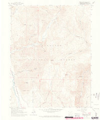
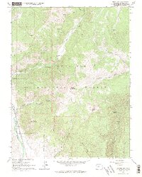
1961 Map of Cement Mountain
USGS Topo · Published 1964About this map
Gunnison National Forest terrain dominates this 1961 survey, where the peaks of Cement Mountain and East Cement Mountain overlook a landscape shaped by early water management and alpine recreation. The Cement Summer Home Group and a nearby Guard Station mark the primary human presence along the winding path of Cement Creek. Geologic and industrial history is evident in the western portion of the sheet, where an abandoned Railroad Grade runs parallel to the East River, tracing the route of former transportation corridors through the high country. Resource management is further highlighted by the Old No 1 Ditch, a testament to the complex irrigation and water rights systems required in this environment. From the steep slopes of Strand Hill to the expansive Granite Basin, the map preserves a detailed record of the trails and gulches that defined this part of Colorado before late-twentieth-century developments.
Find a feature on this map
33 named features on this map. Tap any name to fly to it.
Don’t see what you’re looking for? This feature index may not catch every label — zoom into the map to look around manually.
Map Details
Editions of this 1961 Cement Mountain Map
5 editions found
Other maps of this area

1888 · Crested Butte
USGS Topo · 1:62,500

1889 · Crested Butte
USGS Topo · 1:62,500

1893 · Crested Butte
USGS Topo · 1:62,500

1934 · Taylor Park
USGS Topo · 1:62,500

1937 · Taylor Park
USGS Topo · 1:62,500

1941 · Pitkin
USGS Topo · 1:62,500

1945 · Pitkin
USGS Topo · 1:62,500

1956 · Montrose
USGS Topo · 1:250,000

1959 · Montrose
USGS Topo · 1:250,000

1960 · Montrose
USGS Topo · 1:250,000