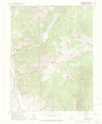
1961 Map of Cement Mountain
USGS Topo · Published 1970About this map
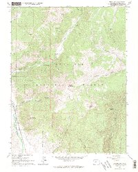
Gunnison National Forest dominates this high-altitude landscape, where deep gulches and prominent peaks defined the early recreational and utility patterns of the region. The map reveals a high-country network of movement, featuring the Farris Pack Trail and numerous other pack and jeep trails that navigate the steep terrain around Cement Mountain and East Cement Mountain. A unique human footprint is visible at the Cement Summer Home Group near the Guard Station, illustrating the mid-century development of seasonal mountain retreats.
Find a feature on this map
35 named features on this map. Tap any name to fly to it.
Don’t see what you’re looking for? This feature index may not catch every label — zoom into the map to look around manually.
Map Details
Editions of this 1961 Cement Mountain Map
5 editions found
Other maps of this area

1888 · Crested Butte
USGS Topo · 1:62,500

1889 · Crested Butte
USGS Topo · 1:62,500

1893 · Crested Butte
USGS Topo · 1:62,500

1934 · Taylor Park
USGS Topo · 1:62,500

1937 · Taylor Park
USGS Topo · 1:62,500

1941 · Pitkin
USGS Topo · 1:62,500

1945 · Pitkin
USGS Topo · 1:62,500

1956 · Montrose
USGS Topo · 1:250,000

1959 · Montrose
USGS Topo · 1:250,000

1960 · Montrose
USGS Topo · 1:250,000