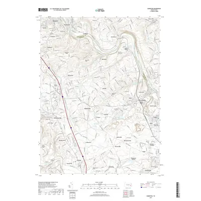
2019 Map of Cementon
USGS Topo · Published 2019About this map
The Lehigh River and the parallel Lehigh Canal define the eastern corridor of this landscape, marking a legacy of industrial transport through Lehigh and Northampton counties. This 2019 survey documents a region where historic hamlets like Egypt, Ironton, and Balliettsville meet modern institutions such as Lehigh Carbon Community College. The map is particularly rich in funerary history, showing numerous sites including the Friedens Church Cem and the poignant Lehigh County Massacre Gravesite.
Find a feature on this map
82 named features on this map. Tap any name to fly to it.
Don’t see what you’re looking for? This feature index may not catch every label — zoom into the map to look around manually.
Map Details
Editions of this 2019 Cementon Map
This is the sole edition of this map. No revisions or reprints were ever made.
Other maps of this area

1894 · Allentown
USGS Topo · 1:62,500

1902 · Slatington
USGS Topo · 1:62,500

1914 · Wind Gap
USGS Topo · 1:62,500

1916 · Wind Gap
USGS Topo · 1:62,500

1922 · Mauch Chunk
USGS Topo · 1:62,500

1924 · Mauch Chunk
USGS Topo · 1:62,500

1937 · Allentown West
USGS Topo · 1:48,000

1939 · Allentown
USGS Topo · 1:62,500

1942 · Allentown West
USGS Topo · 1:62,500

1943 · Mauch Chunk
USGS Topo · 1:62,500
Featured Places
- Slatington, PA
- Egypt, Whitehall
- Cementon, Whitehall
- Balliettsville, North Whitehall Township
- Unionville, North Whitehall Township