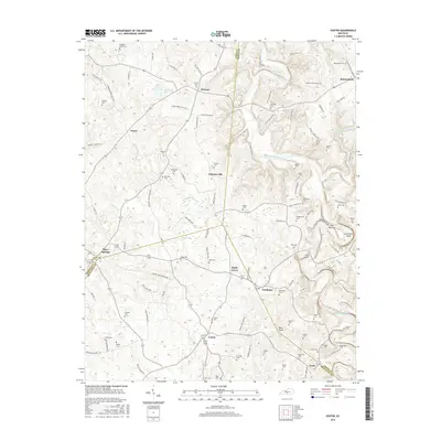
2016 Map of Center
USGS Topo · Published 2016About this map
The Little Barren River winds through the rural landscape of central Kentucky, carving distinctive terrain features such as The Narrows and Horseshoe Bend. This area, situated at the intersection of Hart, Green, Barren, and Metcalfe Counties, is characterized by a dense network of family-named roads and burial grounds. Small communities like Shady Grove, Whickerville, and Crailhope serve as local anchors for the surrounding farmsteads. To the south, Pilot Knob and Crail Hill provide prominent elevation above the river valley. The map reveals a high concentration of small family cemeteries, including Sydnor Cem, McCubbin Cem, and Hedgespeth Cem, which offer significant value for genealogists tracing lineage through this section of the Pennyroyal Plateau. Notable water features include the isolated Hundred Acre Pond and numerous branch streams like Mouser Br and Monroe Br that drain into the winding river system.
Find a feature on this map
116 named features on this map. Tap any name to fly to it.
Don’t see what you’re looking for? This feature index may not catch every label — zoom into the map to look around manually.
Map Details
Editions of this 2016 Center Map
This is the sole edition of this map. No revisions or reprints were ever made.
Other maps of this area

1934 · Munfordville
USGS Topo · 1:48,000

1935 · Horse Cave
USGS Topo · 1:48,000

1937 · Munfordville
USGS Topo · 1:62,500

1938 · Horse Cave
USGS Topo · 1:62,500

1953 · Sulphur Well
USGS Topo · 1:24,000

1953 · Hudgins
USGS Topo · 1:24,000

1953 · Summersville
USGS Topo · 1:24,000

1953 · Exie
USGS Topo · 1:24,000

1953 · Center
USGS Topo · 1:24,000

1953 · East Fork
USGS Topo · 1:24,000