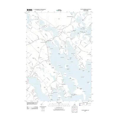
2012 Map of Center Harbor
USGS Topo · Published 2012About this map
Center Harbor serves as a central hub on the northern shores of Lake Winnipesaukee, marking a landscape defined by the intricate transition between land and water. This mapping shows the dense cluster of islands including Bear Island, Threemile Island, and Black Cat Island, which have long shaped the navigational and recreational character of the region. To the north, the elevation rises toward Red Hill, where Red Hill Cem and Bean Cem provide anchor points for local genealogical research near the shores of Lake Kanasatka.
Find a feature on this map
192 named features on this map. Tap any name to fly to it.
Don’t see what you’re looking for? This feature index may not catch every label — zoom into the map to look around manually.
Map Details
Editions of this 2012 Center Harbor Map
This is the sole edition of this map. No revisions or reprints were ever made.
Other maps of this area

1909 · Winnepesaukee
USGS Topo · 1:62,500

1925 · Holderness
USGS Topo · 1:62,500

1927 · Holderness
USGS Topo · 1:62,500

1928 · Plymouth
USGS Topo · 1:62,500

1931 · Plymouth
USGS Topo · 1:62,500

1931 · Mt. Chocorua
USGS Topo · 1:62,500

1949 · Portland
USGS Topo · 1:250,000

1956 · Winnipesaukee
USGS Topo · 1:62,500

1956 · Holderness
USGS Topo · 1:62,500

1956 · Portland
USGS Topo · 1:250,000