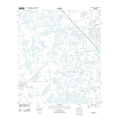
2012 Map of Center Hill
USGS Topo · Published 2012About this map
Center Hill serves as the primary hub in this central Florida landscape, characterized by an intricate network of wetlands, ponds, and small lakes. The map reveals a mosaic of water bodies including Wise Hammock Pond, Honeycut Lake, and Lake Bright, interspersed with named terrain features like Hampton Prairie and the Crowder Holes. Rural industry and research are evidenced by the presence of the University of Florida State Experimental Farm and aviation facilities such as Grass Roots Airpark and the Tex Merritt Private Airstrip. Local history is anchored by several burial grounds, notably Center Hill Cem, Merritt Cem, and Cool Spring Cem. The winding Palatlakaha River cuts through the eastern portion of the sheet, while infrastructure like the Center Hill Water Tower and Groveland Tower punctuate the horizon, marking the transition between agricultural land and recreation at Clear Lake Campground.
Find a feature on this map
94 named features on this map. Tap any name to fly to it.
Don’t see what you’re looking for? This feature index may not catch every label — zoom into the map to look around manually.
Map Details
Editions of this 2012 Center Hill Map
This is the sole edition of this map. No revisions or reprints were ever made.
Other maps of this area

1893 · Panasoffkee
USGS Topo · 1:62,500

1895 · Panasoffkee
USGS Topo · 1:62,500

1955 · Plant City
USGS Topo · 1:250,000

1955 · Orlando
USGS Topo · 1:250,000

1957 · Orlando
USGS Topo · 1:250,000

1958 · Orlando
USGS Topo · 1:250,000

1958 · Plant City
USGS Topo · 1:250,000

1958 · Webster
USGS Topo · 1:24,000

1958 · Bushnell
USGS Topo · 1:24,000

1959 · Plant City
USGS Topo · 1:250,000