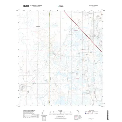
2018 Map of Center Hill
USGS Topo · Published 2018About this map
Hampton Prairie and a dense network of wetlands characterize this central Florida landscape, where the boundary between Sumter and Lake counties meets. Local history and genealogy are centered on established resting places like Center Hill Cem, Cool Spring Cem, and Merritt Cem. The geography is defined by a distinct transition from the rural western reaches near Center Hill to the increasing residential development surrounding Leesburg and Okahumpka in the northeast. This 2018 survey reveals a territory where aviation and water management are critical, featuring both the Tex Merritt Private Airstrip and Grass Roots Airpark, alongside man-made alterations like the Jumper Cr Canal. The drainage patterns of the Palatlakaha River and numerous ponds like Wilson Marsh and Bigeye Hole illustrate the complex hydrography of the region.
Find a feature on this map
101 named features on this map. Tap any name to fly to it.
Don’t see what you’re looking for? This feature index may not catch every label — zoom into the map to look around manually.
Map Details
Editions of this 2018 Center Hill Map
This is the sole edition of this map. No revisions or reprints were ever made.
Other maps of this area

1893 · Panasoffkee
USGS Topo · 1:62,500

1895 · Panasoffkee
USGS Topo · 1:62,500

1955 · Plant City
USGS Topo · 1:250,000

1955 · Orlando
USGS Topo · 1:250,000

1957 · Orlando
USGS Topo · 1:250,000

1958 · Orlando
USGS Topo · 1:250,000

1958 · Plant City
USGS Topo · 1:250,000

1958 · Webster
USGS Topo · 1:24,000

1958 · Bushnell
USGS Topo · 1:24,000

1959 · Plant City
USGS Topo · 1:250,000