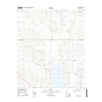
2015 Map of Center Hill
USGS Topo · Published 2015About this map
Okatibbee Lake and its surrounding wetlands define the central landscape of this East Mississippi region, where the Kemper and Lauderdale county line divides the terrain. Small, dispersed settlements like Martin and Shucktown are connected by a network of rural roads such as Chisholm Rd and Martin Kemper Co Rd, reflecting a landscape dedicated to timber and small-scale agriculture. The area is dotted with numerous family and community burial grounds, including Klondike Cem and Pine Forest Cem, which serve as vital markers for local genealogical research. Numerous waterways like Okatibbee Cr, Chickasawhay Cr, and Souenlovie Cr feed into the reservoir system, illustrating the intricate drainage pattern of the Upper Pascagoula basin. This survey documents the modern intersection of public infrastructure and the long-established rural community footprints of Center Hill and Klondike.
Find a feature on this map
95 named features on this map. Tap any name to fly to it.
Don’t see what you’re looking for? This feature index may not catch every label — zoom into the map to look around manually.
Map Details
Editions of this 2015 Center Hill Map
This is the sole edition of this map. No revisions or reprints were ever made.
Other maps of this area

1921 · Meridian
USGS Topo · 1:48,000

1923 · Meridian
USGS Topo · 1:62,500

1953 · Meridian
USGS Topo · 1:250,000

1957 · Meridian
USGS Topo · 1:250,000

1957 · Chunky
USGS Topo · 1:62,500

1962 · House
USGS Topo · 1:24,000

1962 · Daleville
USGS Topo · 1:24,000

1962 · Lauderdale NW
USGS Topo · 1:24,000

1962 · Center Hill
USGS Topo · 1:24,000

1962 · Post
USGS Topo · 1:24,000