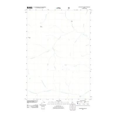
2011 Map of Center Mountain
USGS Topo · Published 2011About this map
Center Mountain and Snowslide Peak anchor this remote high-country landscape in Valley County, where the topography is defined by the extensive drainage systems of the Monumental Creek watershed. The map details a complex network of alpine waterways, including the convergence of the West Fork Monumental Creek and North Fork Monumental Creek. The presence of Thunder City at the southern edge suggests a focal point for human activity in a region otherwise characterized by steep drainages like Slide Gulch and Snowslide Creek. The intricate labeling of smaller tributaries such as Beehive Creek, Talc Creek, and Mud Creek provides essential data for understanding the hydrography and access routes through this part of the Idaho wilderness as it was documented in the early 21st century.
Find a feature on this map
16 named features on this map. Tap any name to fly to it.
Don’t see what you’re looking for? This feature index may not catch every label — zoom into the map to look around manually.
Map Details
Editions of this 2011 Center Mountain Map
This is the sole edition of this map. No revisions or reprints were ever made.
Other maps of this area

1937 · Yellow Pine
USGS Topo · 1:48,000

1937 · Big Creek
USGS Topo · 1:48,000

1942 · Big Creek
USGS Topo · 1:62,500

1943 · Yellow Pine
USGS Topo · 1:62,500

1956 · Elk City
USGS Topo · 1:250,000

1957 · Challis
USGS Topo · 1:250,000

1960 · Elk City
USGS Topo · 1:250,000

1960 · Challis
USGS Topo · 1:250,000

1963 · Challis
USGS Topo · 1:250,000

1969 · Edwardsburg
USGS Topo · 1:24,000