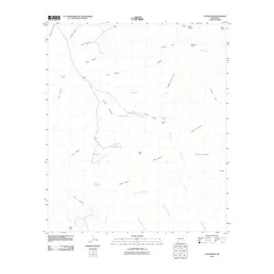
2010 Map of Center Peak
USGS Topo · Published 2010About this map
The Animas Mountains of Hidalgo County define this high-desert landscape, where ranching and mineral exploration shaped the remote terrain. This 2010 survey details a network of family-named ranch sites and seasonal water management, featuring O K Bar Ranch, Lawhorns Ranch, and Tullous Upper Ranch. The presence of the Athena Mine and Athena Prospect Number 2 in the northern reaches points to the region's mining interests, while scattered sites like Henrys Cabin offer clues for local genealogists. Named topographic landmarks such as Center Peak, Elephant Butte, and 7K Peak serve as primary anchors. The drainage system is heavily articulated through features like Double Adobe Creek and the Middle Fork Brushy Creek, supported by a series of essential livestock reservoirs including Gibson Tank and Frankie Tank.
Find a feature on this map
43 named features on this map. Tap any name to fly to it.
Don’t see what you’re looking for? This feature index may not catch every label — zoom into the map to look around manually.
Map Details
Editions of this 2010 Center Peak Map
This is the sole edition of this map. No revisions or reprints were ever made.
Other maps of this area

1917 · Antelope Wells
USGS Topo · 1:62,500

1918 · Walnut Wells
USGS Topo · 1:62,500

1918 · Cienega Springs
USGS Topo · 1:62,500

1918 · Animas Peak
USGS Topo · 1:62,500

1919 · Antelope Wells
USGS Topo · 1:62,500

1920 · Animas Peak
USGS Topo · 1:62,500

1923 · Walnut Wells
USGS Topo · 1:62,500

1955 · Douglas
USGS Topo · 1:250,000

1959 · Douglas
USGS Topo · 1:250,000

1961 · Douglas
USGS Topo · 1:250,000