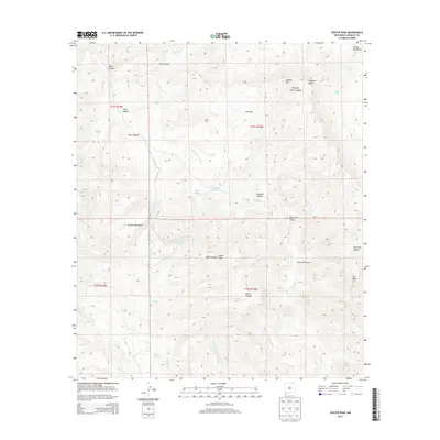
2013 Map of Center Peak
USGS Topo · Published 2013About this map
The Animas Mountains dominate this high-desert landscape in the southwestern corner of New Mexico, where the terrain is defined by complex drainage systems and volcanic landforms. Prominent landmarks such as Center Peak and Elephant Butte rise above deep-cut ravines like Bear Canyon and Post Canyon. The geography reflects a ranching-focused economy, with numerous named water sources scattered across the dry sections, including Cowboy Spring, Bennett Spring, and artificial catchments such as Tullous Tank and Frankie Tank. These features indicate the essential infrastructure required for livestock management in this arid environment. The map provides a detailed view of the natural water distribution and topography at the headwaters of Walnut Cr and Middle Fork Brushy Cr, showing the transition from mountain ridges down to the alluvial plains and canyons that define the San Simon Valley region.
Find a feature on this map
40 named features on this map. Tap any name to fly to it.
Don’t see what you’re looking for? This feature index may not catch every label — zoom into the map to look around manually.
Map Details
Editions of this 2013 Center Peak Map
This is the sole edition of this map. No revisions or reprints were ever made.
Other maps of this area

1917 · Antelope Wells
USGS Topo · 1:62,500

1918 · Walnut Wells
USGS Topo · 1:62,500

1918 · Cienega Springs
USGS Topo · 1:62,500

1918 · Animas Peak
USGS Topo · 1:62,500

1919 · Antelope Wells
USGS Topo · 1:62,500

1920 · Animas Peak
USGS Topo · 1:62,500

1923 · Walnut Wells
USGS Topo · 1:62,500

1955 · Douglas
USGS Topo · 1:250,000

1959 · Douglas
USGS Topo · 1:250,000

1961 · Douglas
USGS Topo · 1:250,000