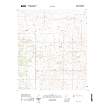
2023 Map of Center Peak
USGS Topo · Published 2023About this map
The Animas Mountains dominate this high-desert landscape in the southwestern corner of New Mexico, where the terrain is defined by a complex network of canyons and peaks. Notable landmarks like Center Peak and 7K Peak rise above deep drainages such as Bear Canyon and Lawhorn Canyon. The map reveals a land managed for water resources, indicated by numerous tanks including Rock Guard Tank, Frankie Tank, and Tahoe Tank. These catchments, alongside names like Cowboy Rim and Cowboy Creek, suggest a history of ranching and land use tailored to the arid environment. Along the eastern edge, Elephant Butte stands near the divide where waters flow toward Walnut Creek and the East Fork Brushy Creek. This modern survey provides a detailed view of the drainage patterns and relief that have shaped navigation and livestock movement in Hidalgo County for decades.
Find a feature on this map
39 named features on this map. Tap any name to fly to it.
Don’t see what you’re looking for? This feature index may not catch every label — zoom into the map to look around manually.
Map Details
Editions of this 2023 Center Peak Map
This is the sole edition of this map. No revisions or reprints were ever made.
Other maps of this area

1917 · Antelope Wells
USGS Topo · 1:62,500

1918 · Walnut Wells
USGS Topo · 1:62,500

1918 · Cienega Springs
USGS Topo · 1:62,500

1918 · Animas Peak
USGS Topo · 1:62,500

1919 · Antelope Wells
USGS Topo · 1:62,500

1920 · Animas Peak
USGS Topo · 1:62,500

1923 · Walnut Wells
USGS Topo · 1:62,500

1955 · Douglas
USGS Topo · 1:250,000

1959 · Douglas
USGS Topo · 1:250,000

1961 · Douglas
USGS Topo · 1:250,000