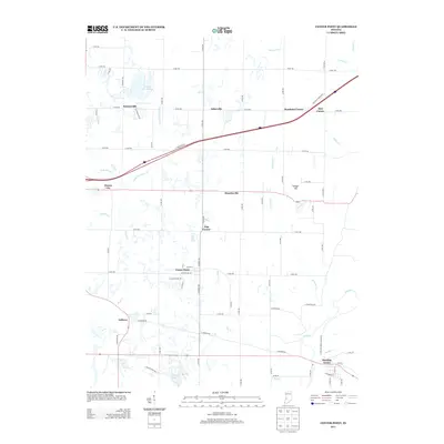
2013 Map of Center Point
USGS Topo · Published 2013About this map
Center Point sits at the heart of this Clay County landscape, where a grid of rural roads connects several small settlements and historic crossroads. The drainage patterns of Hog Cr and Birch Cr influence the local topography, leading toward the southeastern corner where the Eel River and Jordan Cr converge near Bowling Green. This area demonstrates the persistent layout of Indiana's agricultural heartland, with communities like Ashboro, Hoosierville, and Asherville maintaining their distinct identities along established routes like N Meridian Rd and Harmony Rd.
Find a feature on this map
66 named features on this map. Tap any name to fly to it.
Don’t see what you’re looking for? This feature index may not catch every label — zoom into the map to look around manually.
Map Details
Editions of this 2013 Center Point Map
This is the sole edition of this map. No revisions or reprints were ever made.
Other maps of this area

1908 · Clay City
USGS Topo · 1:48,000

1910 · Clay City
USGS Topo · 1:62,500

1950 · Brazil East
USGS Topo · 1:24,000

1950 · Brazil West
USGS Topo · 1:24,000

1952 · Reelsville
USGS Topo · 1:24,000

1953 · Indianapolis
USGS Topo · 1:250,000

1956 · Indianapolis
USGS Topo · 1:250,000

1956 · Patricksburg
USGS Topo · 1:24,000

1957 · Indianapolis
USGS Topo · 1:250,000
1957 · Center Point
USGS Topo · 1:24,000