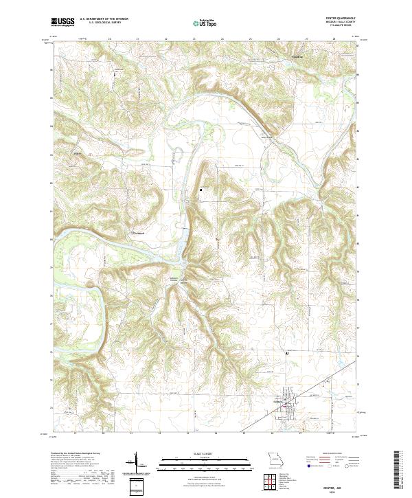
2021 Map of Center
USGS Topo · Published 2021About this map
Center anchors the southern landscape of this Ralls County survey, where the local road network converges around Bus Barn Ln and State Hwy CC. To the north, the Salt River carves a winding path through the terrain, bridged at the historic crossing of Asher Bridge. The map documents several small settlements and rural communities including Spalding, Hatch, and Cincinnati, which are connected by a web of named tracks such as Asher Bridge Trl and Red Bud Trl. For those tracing local families, the survey marks established burial grounds like Norton Cem, Olivet Cem, and Greathouse Cem. The topography is defined by the drainage systems of Lick Cr and Sugar Cr, alongside the deeply cut features of Johnson Hollow and Griffin Hollow.
Find a feature on this map
66 named features on this map. Tap any name to fly to it.
Don’t see what you’re looking for? This feature index may not catch every label — zoom into the map to look around manually.
Map Details
Editions of this 2021 Center Map
This is the sole edition of this map. No revisions or reprints were ever made.
Other maps of this area

1890 · Louisiana
USGS Topo · 1:125,000

1890 · Mexico
USGS Topo · 1:125,000

1903 · Palmyra
USGS Topo · 1:125,000

1932 · Hannibal
USGS Topo · 1:62,500

1936 · Hannibal
USGS Topo · 1:48,000

1943 · Vandalia
USGS Topo · 1:62,500

1945 · Hannibal
USGS Topo · 1:62,500

1945 · Perry
USGS Topo · 1:62,500

1945 · Vandalia
USGS Topo · 1:62,500

1948 · Quincy
USGS Topo · 1:250,000