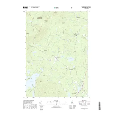
2018 Map of Center Sandwich
USGS Topo · Published 2018About this map
Center Sandwich and North Sandwich serve as the primary hubs in this New Hampshire landscape, where the northern foothills of the Ossipee Mountains meet the northern reaches of Squam Lake. The terrain is defined by dramatic elevation shifts, moving from the waters of Sandwich Bay up toward the high peaks of Mt Israel and Young Mtn. A significant portion of the northern map area is preserved within the White Mountain National Forest, featuring an extensive network of trails and rugged forest roads like Guinea Pond Trail and Sidehill Powerline Snowmo.
Find a feature on this map
106 named features on this map. Tap any name to fly to it.
Don’t see what you’re looking for? This feature index may not catch every label — zoom into the map to look around manually.
Map Details
Editions of this 2018 Center Sandwich Map
This is the sole edition of this map. No revisions or reprints were ever made.
Other maps of this area

1909 · Winnepesaukee
USGS Topo · 1:62,500

1925 · Holderness
USGS Topo · 1:62,500

1927 · Holderness
USGS Topo · 1:62,500

1928 · Plymouth
USGS Topo · 1:62,500

1931 · Plymouth
USGS Topo · 1:62,500

1931 · Mt. Chocorua
USGS Topo · 1:62,500

1949 · Portland
USGS Topo · 1:250,000

1956 · Winnipesaukee
USGS Topo · 1:62,500

1956 · Holderness
USGS Topo · 1:62,500

1956 · Portland
USGS Topo · 1:250,000
Featured Places
- Moultonborough, NH
- Sandwich, NH
- Sandwich Landing, Sandwich
- Big Rock Corner, Sandwich
- Browns Point, Moultonborough