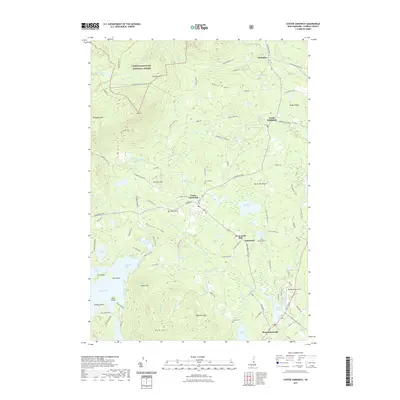
2021 Map of Center Sandwich
USGS Topo · Published 2021About this map
Center Sandwich and the surrounding villages in Carroll County sit at the edge of the White Mountain National Forest, where the topography transitions from the high peaks of Mt Israel and Dinsmore Mtn to the expansive waters of Squam Lake. This modern survey documents the complex network of mountain drainages, including the Cold River and Bearcamp River, that define the local geography. The map reveals a settlement pattern focused around historical hubs like North Sandwich and Whiteface, connected by old routes such as Sandwich Notch Rd and Whittier St.
Find a feature on this map
115 named features on this map. Tap any name to fly to it.
Don’t see what you’re looking for? This feature index may not catch every label — zoom into the map to look around manually.
Map Details
Editions of this 2021 Center Sandwich Map
This is the sole edition of this map. No revisions or reprints were ever made.
Other maps of this area

1909 · Winnepesaukee
USGS Topo · 1:62,500

1925 · Holderness
USGS Topo · 1:62,500

1927 · Holderness
USGS Topo · 1:62,500

1928 · Plymouth
USGS Topo · 1:62,500

1931 · Plymouth
USGS Topo · 1:62,500

1931 · Mt. Chocorua
USGS Topo · 1:62,500

1949 · Portland
USGS Topo · 1:250,000

1956 · Winnipesaukee
USGS Topo · 1:62,500

1956 · Holderness
USGS Topo · 1:62,500

1956 · Portland
USGS Topo · 1:250,000
Featured Places
- Moultonborough, NH
- Sandwich, NH
- Sandwich Landing, Sandwich
- Big Rock Corner, Sandwich
- Browns Point, Moultonborough