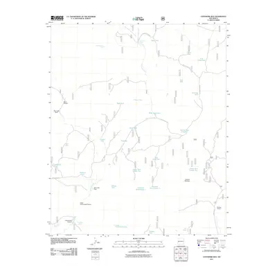
2011 Map of Centerfire Bog
USGS Topo · Published 2011About this map
Centerfire Creek and its complex network of forks and draws dominate this high-elevation corner of New Mexico as it was mapped in 2011. The landscape is defined by its critical water management infrastructure, evidenced by dozens of stock tanks including Miner Tank, Dead Horse Tank, and Funderburg Tank. These named catchments, interspersed with natural features like Todd Browning Spring and Rita Blanca Spring, trace the ongoing importance of livestock grazing in the region. The geography transitions from the wide Spur Lake Basin to the prominent heights of Freeman Mountain, while a network of service routes like Forestry Road 308 and Center Fire Rd provide access through the canyons. This map offers a detailed view of the remote drainage systems and naming conventions of local ranching families and early settlers in the vicinity of Arroyo Grande and Upper Cottonwood Canyon.
Find a feature on this map
45 named features on this map. Tap any name to fly to it.
Don’t see what you’re looking for? This feature index may not catch every label — zoom into the map to look around manually.
Map Details
Editions of this 2011 Centerfire Bog Map
This is the sole edition of this map. No revisions or reprints were ever made.
Other maps of this area

1915 · Reserve
USGS Topo · 1:125,000

1918 · Reserve
USGS Topo · 1:125,000

1954 · Clifton
USGS Topo · 1:250,000

1954 · Saint Johns
USGS Topo · 1:250,000

1957 · Clifton
USGS Topo · 1:250,000

1957 · Saint Johns
USGS Topo · 1:250,000

1958 · Clifton
USGS Topo · 1:250,000

1958 · Saint Johns
USGS Topo · 1:250,000

1962 · Clifton
USGS Topo · 1:250,000

1962 · Saint Johns
USGS Topo · 1:250,000