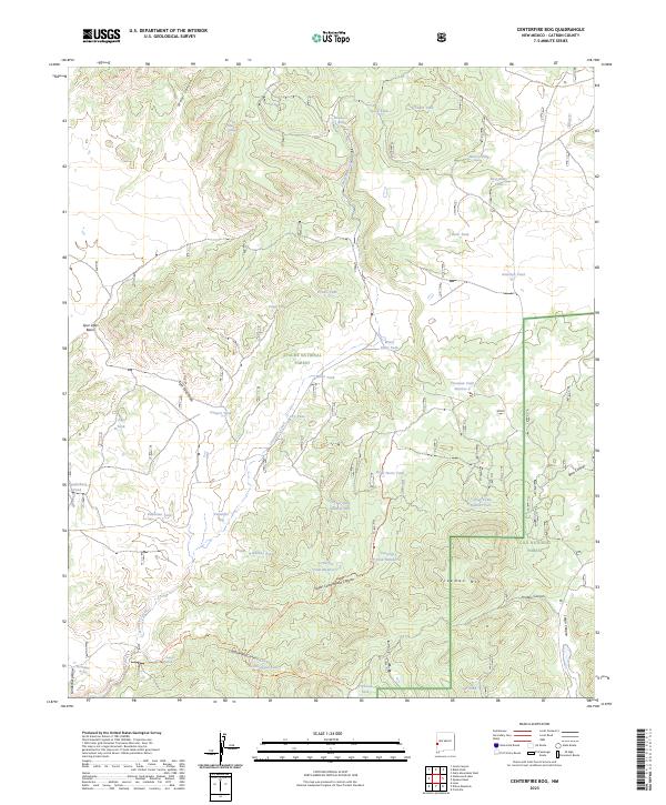
2023 Map of Centerfire Bog
USGS Topo · Published 2023About this map
Centerfire Bog lies at the heart of this high-altitude landscape, where the headwaters of Centerfire Creek transition between the Apache National Forest and Gila National Forest. The map reveals a complex network of water management features essential for high-country ranching and forest management, including numerous livestock tanks like Fifteen Tank and Rock Tank. The presence of Todd Browning Spring, Funderburg Spring, and Cienega Spring suggests a reliance on scattered groundwater sources across the varied terrain of Spur Lake Basin and the winding Upper Cottonwood Canyon. This area, characterized by deep draws and isolated peaks such as Freeman Mtn, highlights the intersection of public land administration and the practical requirements of water access in the New Mexico backcountry.
Find a feature on this map
54 named features on this map. Tap any name to fly to it.
Don’t see what you’re looking for? This feature index may not catch every label — zoom into the map to look around manually.
Map Details
Editions of this 2023 Centerfire Bog Map
This is the sole edition of this map. No revisions or reprints were ever made.
Other maps of this area

1915 · Reserve
USGS Topo · 1:125,000

1918 · Reserve
USGS Topo · 1:125,000

1954 · Clifton
USGS Topo · 1:250,000

1954 · Saint Johns
USGS Topo · 1:250,000

1957 · Clifton
USGS Topo · 1:250,000

1957 · Saint Johns
USGS Topo · 1:250,000

1958 · Clifton
USGS Topo · 1:250,000

1958 · Saint Johns
USGS Topo · 1:250,000

1962 · Clifton
USGS Topo · 1:250,000

1962 · Saint Johns
USGS Topo · 1:250,000