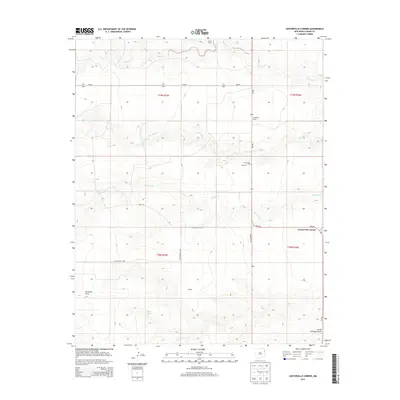
2013 Map of Centerville Corner
USGS Topo · Published 2013About this map
Centerville Corner sits at the junction of NM-402 and Co Highway C-093 in a landscape defined by the drainage networks of the high plains. This northeastern New Mexico region is characterized by established ranching operations, including the Cain Ranch, Copeland Ranch, and Koger Ranch, which signify the long-standing agricultural roots of Union County. The presence of Fairmount Cem near the small settlement of Fairview provides a focal point for genealogical interest, marking the endurance of early rural communities. Local transit and cattle movement are reflected in the network of secondary routes like Robertson RD and Ione RD, while the undulating terrain is carved by seasonal watercourses such as Monia Cr, Entrania Cr, and the branching Bob Wells Cr. The topographical detail captures the transition from open range to the distinct depressions of Fullingim Draw and the South Fullingim Draw.
Find a feature on this map
25 named features on this map. Tap any name to fly to it.
Don’t see what you’re looking for? This feature index may not catch every label — zoom into the map to look around manually.
Map Details
Editions of this 2013 Centerville Corner Map
This is the sole edition of this map. No revisions or reprints were ever made.
Other maps of this area

1954 · Tucumcari
USGS Topo · 1:250,000

1958 · Tucumcari
USGS Topo · 1:250,000

1966 · Ione
USGS Topo · 1:24,000

1966 · Hayden
USGS Topo · 1:24,000

1966 · Cherokee Valley
USGS Topo · 1:24,000

1971 · Kerlin Hill
USGS Topo · 1:24,000

1971 · Koger Ranch
USGS Topo · 1:24,000

1971 · Centerville Corner
USGS Topo · 1:24,000

1971 · Doyle Hill
USGS Topo · 1:24,000

1971 · Amistad SE
USGS Topo · 1:24,000