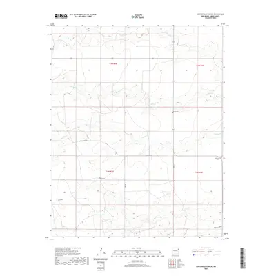
2020 Map of Centerville Corner
USGS Topo · Published 2020About this map
Centerville Corner marks a junction in the wide high plains of Union County, New Mexico, where the remote road network of the High Plains meets the natural drainage systems of the Canadian River watershed. The landscape is defined by the ephemeral tracks of Monia Creek, Bob Wells Cr, and Entrania Cr, which carve shallow paths through the terrain. Evidence of early ranching and rural settlement is sparse but significant, anchored by the Fairview Cem and livestock water sources like the Slash F Tank.
Find a feature on this map
19 named features on this map. Tap any name to fly to it.
Don’t see what you’re looking for? This feature index may not catch every label — zoom into the map to look around manually.
Map Details
Editions of this 2020 Centerville Corner Map
This is the sole edition of this map. No revisions or reprints were ever made.
Other maps of this area

1954 · Tucumcari
USGS Topo · 1:250,000

1958 · Tucumcari
USGS Topo · 1:250,000

1966 · Ione
USGS Topo · 1:24,000

1966 · Hayden
USGS Topo · 1:24,000

1966 · Cherokee Valley
USGS Topo · 1:24,000

1971 · Kerlin Hill
USGS Topo · 1:24,000

1971 · Koger Ranch
USGS Topo · 1:24,000

1971 · Centerville Corner
USGS Topo · 1:24,000

1971 · Doyle Hill
USGS Topo · 1:24,000

1971 · Amistad SE
USGS Topo · 1:24,000