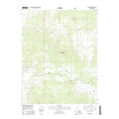
2017 Map of Central East
USGS Topo · Published 2017About this map
The Dixie National Forest defines the mountain landscape of this 2017 survey, where high-elevation terrain transitions into the valley floor near Central. The eastern edge of the map is dominated by the community of Pine Valley, situated near the Pine Valley Cem and the confluence of several mountain streams. Water management and local recreation are central to the area's layout, evidenced by the Four Mile Bench Sewage Lagoon on the Fourmile Bench and a network of dedicated paths including the Grass Valley ATV Trail UT238 and the Equestrian Trail.
Find a feature on this map
51 named features on this map. Tap any name to fly to it.
Don’t see what you’re looking for? This feature index may not catch every label — zoom into the map to look around manually.
Map Details
Editions of this 2017 Central East Map
This is the sole edition of this map. No revisions or reprints were ever made.
Other maps of this area

1885 · St. George
USGS Topo · 1:250,000

1891 · St. George
USGS Topo · 1:250,000

1950 · Iron Mountain
USGS Topo · 1:62,500

1950 · Page Ranch
USGS Topo · 1:24,000

1951 · Page Ranch
USGS Topo · 1:24,000

1953 · Cedar City
USGS Topo · 1:250,000

1957 · New Harmony
USGS Topo · 1:62,500

1958 · Cedar City
USGS Topo · 1:250,000

1962 · Cedar City
USGS Topo · 1:250,000
1972 · Pinto
USGS Topo · 1:24,000