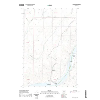
2020 Map of Central Ferry
USGS Topo · Published 2020About this map
Central Ferry and the Snake River corridor define this agricultural landscape along the border of Whitman and Garfield Counties. The topography is characterized by deep drainage systems like Cottonwood Canyon and numerous gulches that cut through the high plateau down to the riverbank. Small settlements such as Purrington and Peyton dot the shoreline, illustrating the region's historic reliance on river access and cross-river transport. The presence of Schoolhouse Draw points to the early social centers established by homesteading families in this part of Washington. Modern infrastructure is represented by the Central Ferry Bridge, which replaced earlier transit methods, while a network of rural routes like Big Alkali Rd and Church Hill Rd connect the isolated draws and bars, including Hastings Bar and Hammer Gulch, to the wider Palouse region.
Find a feature on this map
31 named features on this map. Tap any name to fly to it.
Don’t see what you’re looking for? This feature index may not catch every label — zoom into the map to look around manually.
Map Details
Editions of this 2020 Central Ferry Map
This is the sole edition of this map. No revisions or reprints were ever made.
Other maps of this area

1950 · La Crosse
USGS Topo · 1:62,500

1950 · Penawawa
USGS Topo · 1:62,500

1950 · Endicott
USGS Topo · 1:62,500

1950 · Hay
USGS Topo · 1:62,500

1952 · Hay
USGS Topo · 1:62,500

1952 · La Crosse
USGS Topo · 1:62,500

1955 · Pullman
USGS Topo · 1:250,000

1958 · Pullman
USGS Topo · 1:250,000

1981 · Dusty
USGS Topo · 1:24,000
1981 · La Crosse West
USGS Topo · 1:24,000