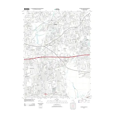
2013 Map of Central Islip
USGS Topo · Published 2013About this map
Central Islip and its surrounding hamlets are defined by a dense network of suburban residential streets and major transit corridors in the early twenty-first century. The southern portion of the map is significantly marked by the Old Central Islip Psychiatric Center Patient Cem, a somber remainder of the area's massive institutional history. Transportation is central to the landscape, with the Long Island RR cutting east-west through Brentwood and Islandia, while high-capacity thoroughfares like the Long Island Expy and Motor Pkwy facilitate the region's commuter-driven economy. In the north, the headwaters of the Nissequogue River at New Millpond contrast with the heavy development. Local heritage is preserved in several small burial grounds, including the Hauppauge Methodist Episcopal Cem and Saint Patricks Cem, which sit amidst contemporary infrastructure and newer settlements like Nesconset and East Hauppauge.
Find a feature on this map
42 named features on this map. Tap any name to fly to it.
Don’t see what you’re looking for? This feature index may not catch every label — zoom into the map to look around manually.
Map Details
Editions of this 2013 Central Islip Map
This is the sole edition of this map. No revisions or reprints were ever made.
Other maps of this area

1901 · Babylon
USGS Topo · 1:62,500

1901 · Northport
USGS Topo · 1:62,500

1902 · Setauket
USGS Topo · 1:62,500

1902 · Fire Island
USGS Topo · 1:62,500

1903 · Babylon
USGS Topo · 1:62,500

1903 · Northport
USGS Topo · 1:62,500

1903 · Fire Island
USGS Topo · 1:62,500

1904 · Setauket
USGS Topo · 1:62,500

1904 · Islip
USGS Topo · 1:125,000

1919 · Setauket
USGS Topo · 1:62,500