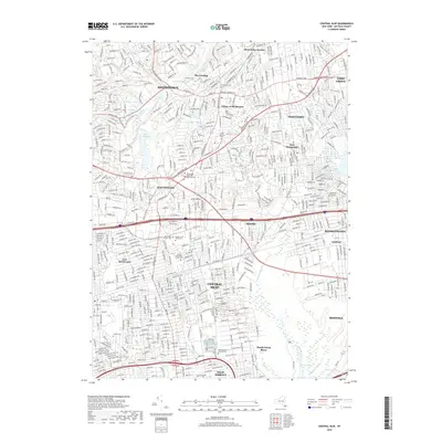
2019 Map of Central Islip
USGS Topo · Published 2019About this map
Smithtown and the Nissequogue River anchor the northern landscape of this Suffolk County region, where residential expansion meets established village centers. The map documents a densely developed suburban corridor defined by major thoroughfares like the Jericho Tpke and Express Dr, yet it preserves significant historical landmarks. Several religious and institutional burial grounds are identified, including the Saint Patrick Cem and the Willard State Hospital Cem near Central Islip.
Find a feature on this map
53 named features on this map. Tap any name to fly to it.
Don’t see what you’re looking for? This feature index may not catch every label — zoom into the map to look around manually.
Map Details
Editions of this 2019 Central Islip Map
This is the sole edition of this map. No revisions or reprints were ever made.
Other maps of this area

1901 · Babylon
USGS Topo · 1:62,500

1901 · Northport
USGS Topo · 1:62,500

1902 · Setauket
USGS Topo · 1:62,500

1902 · Fire Island
USGS Topo · 1:62,500

1903 · Babylon
USGS Topo · 1:62,500

1903 · Northport
USGS Topo · 1:62,500

1903 · Fire Island
USGS Topo · 1:62,500

1904 · Setauket
USGS Topo · 1:62,500

1904 · Islip
USGS Topo · 1:125,000

1919 · Setauket
USGS Topo · 1:62,500