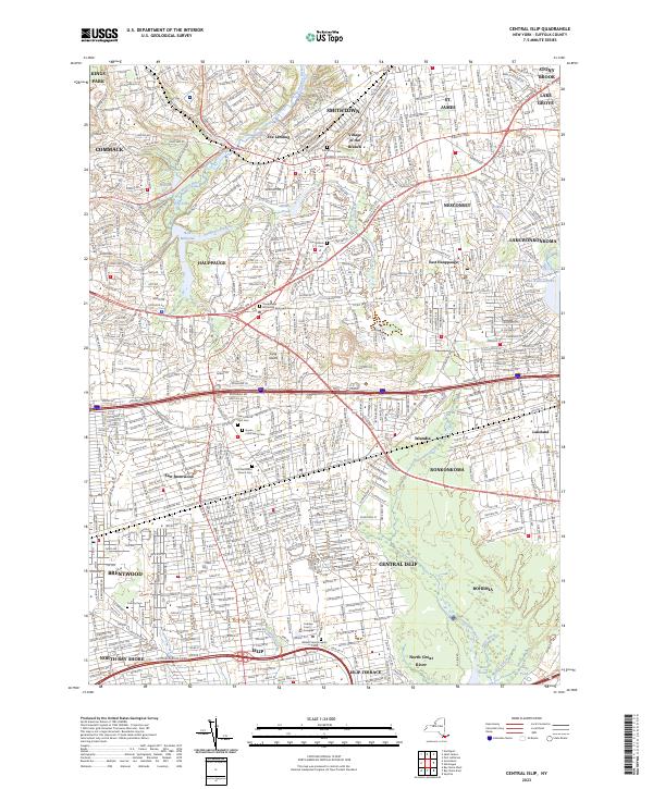
2023 Map of Central Islip
USGS Topo · Published 2023About this map
Central Islip and its surrounding Suffolk County communities are defined by a dense network of suburban development and historic institutions. Large-scale facilities such as the Willard State Hospital and the Cohalan Court Complex stand near the Long Island railroad line, illustrating the area's role as a regional administrative hub. The landscape is dotted with numerous local landmarks of genealogical significance, including the Hauppauge Methodist Episcopal Cem and Saint Patrick Cem.
Find a feature on this map
76 named features on this map. Tap any name to fly to it.
Don’t see what you’re looking for? This feature index may not catch every label — zoom into the map to look around manually.
Map Details
Editions of this 2023 Central Islip Map
This is the sole edition of this map. No revisions or reprints were ever made.
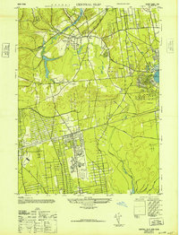
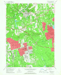
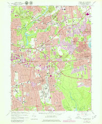
Historical Maps of Islandia Through Time
4 maps found