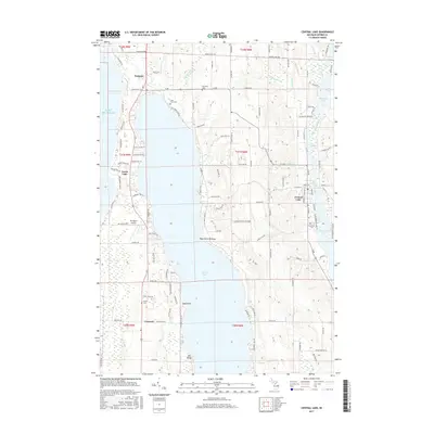
2017 Map of Central Lake
USGS Topo · Published 2017About this map
Torch Lake and the Intermediate River system define the geography of this Antrim County landscape, where the narrow peninsula between the glacial waters supports small northern Michigan communities. At the northern end, Eastport sits at the junction of M-88 and Old Dixie Hwy, while Central Lake serves as the interior hub between Hanley Lake and the larger Intermediate Lake. The map details the rural character of the area through several family and community burial grounds, including Southern Cem and Lake View Cem. Near the shore of Lake Michigan, topographical features like Old Baldy and Sand Point mark the transition from the sandy coast to the high ridges of Cedar Ridge. Evidence of local infrastructure is seen at Torchport Airport and the winding course of Voisinet Cr, illustrating how development has historically followed the waterways and the natural contours of the land.
Find a feature on this map
122 named features on this map. Tap any name to fly to it.
Don’t see what you’re looking for? This feature index may not catch every label — zoom into the map to look around manually.
Map Details
Editions of this 2017 Central Lake Map
This is the sole edition of this map. No revisions or reprints were ever made.
Other maps of this area

1954 · Central Lake
USGS Topo · 1:62,500

1954 · Traverse City
USGS Topo · 1:250,000

1955 · Cheboygan
USGS Topo · 1:250,000

1956 · Mancelona
USGS Topo · 1:62,500

1957 · Elk Rapids
USGS Topo · 1:62,500

1958 · Cheboygan
USGS Topo · 1:250,000

1958 · Traverse City
USGS Topo · 1:250,000

1961 · Boyne City
USGS Topo · 1:62,500

1975 · Mancelona NW
USGS Topo · 1:24,000

1975 · Boyne City NW
USGS Topo · 1:24,000