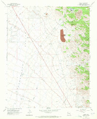
1968 Map of Cerbat
USGS Topo · Published 1972About this map
Mineral Park serves as a focal point for this late-1960s landscape, where industrial mining and early roadside curiosities meet in the high desert. The map captures a transition from the historic mining district near Ithaca Peak and Turquoise Mtn to the modern logistics of the Mineral Park Landing Strip Road. The presence of the Mineral Park Cem and several specialized mining operations, such as the Emerald Isle Mine and Golden Gem Mine, highlights the long-standing mineral extraction economy of the Cerbat Mountains. To the west, the arid expanse of the Sacramento Valley is punctuated by the whimsical settlement of Santa Claus, contrasting with the heavy industrial footprint of the Tailings Pond and Industrial Waste Ponds. A network of drainage systems like Cerbat Wash and Thirteenmile Wash defines the rugged terrain between the peaks and the valley floor.
Find a feature on this map
44 named features on this map. Tap any name to fly to it.
Don’t see what you’re looking for? This feature index may not catch every label — zoom into the map to look around manually.
Map Details
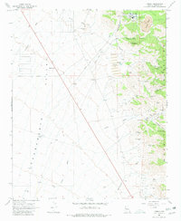
Editions of this 1968 Cerbat Map
2 editions found
Other maps of this area

1886 · Camp Mohave
USGS Topo · 1:250,000

1892 · Camp Mohave
USGS Topo · 1:250,000

1939 · Chloride
USGS Topo · 1:48,000

1942 · Camp Mohave
USGS Topo · 1:250,000

1944 · Chloride
USGS Topo · 1:62,500

1947 · Kingman
USGS Topo · 1:250,000

1948 · Kingman
USGS Topo · 1:250,000

1954 · Kingman
USGS Topo · 1:250,000

1955 · Kingman
USGS Topo · 1:250,000

1958 · Kingman
USGS Topo · 1:250,000