
1901 Map of Ceredo
USGS Topo · Published 1953About this map
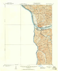
The tri-state junction where West Virginia, Ohio, and Kentucky meet defines the character of this turn-of-the-century river landscape. The Ohio River and Big Sandy River serve as the primary geographical anchors, supporting a dense network of major railroads including the Norfolk and Western Ry, Chesapeake and Ohio Ry, and the Baltimore and Ohio RR. These rail lines converge at Kenova, a critical transportation hub, and pass through neighboring Ceredo.
Find a feature on this map
39 named features on this map. Tap any name to fly to it.
Don’t see what you’re looking for? This feature index may not catch every label — zoom into the map to look around manually.
Map Details
Editions of this 1901 Ceredo Map
2 editions found
Other maps of this area

1892 · Huntington
USGS Topo · 1:125,000

1898 · Huntington
USGS Topo · 1:125,000

1898 · Ironton
USGS Topo · 1:62,500

1900 · Ironton
USGS Topo · 1:62,500

1901 · Guyandot
USGS Topo · 1:62,500

1902 · Guyandot
USGS Topo · 1:62,500

1903 · Kenova
USGS Topo · 1:125,000

1904 · Kenova
USGS Topo · 1:125,000

1906 · Athalia
USGS Topo · 1:62,500

1908 · Athalia
USGS Topo · 1:62,500