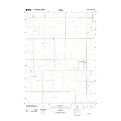
2011 Map of Ceresco
USGS Topo · Published 2011About this map
Ceresco serves as the primary hub of this agricultural landscape in Saunders County, centered around its local Ceresco Post Office. The surrounding countryside is defined by a grid of well-maintained county roads and an intricate network of waterways, including Rock Creek and its various tributaries like North Fork Rock Creek and Little Rock Creek. This landscape reflects a sophisticated water management system with several named dams and impoundments, such as Palm Reservoir, Edgar Reservoir, and Marshalek Reservoir. Local history is preserved at several rural burial grounds, including Fridhem Cemetery in the north and Saint Patrick Cemetery to the south. The layout of the region, from the residential streets of the town to the reaches of Ash Hollow Creek, illustrates the enduring structure of Nebraska's rural communities in the early 21st century.
Find a feature on this map
39 named features on this map. Tap any name to fly to it.
Don’t see what you’re looking for? This feature index may not catch every label — zoom into the map to look around manually.
Map Details
Editions of this 2011 Ceresco Map
This is the sole edition of this map. No revisions or reprints were ever made.
Other maps of this area

1897 · Lincoln
USGS Topo · 1:125,000

1899 · Wahoo
USGS Topo · 1:125,000

1955 · Fremont
USGS Topo · 1:250,000

1955 · Lincoln
USGS Topo · 1:250,000

1957 · Fremont
USGS Topo · 1:250,000

1957 · Lincoln
USGS Topo · 1:250,000

1958 · Fremont
USGS Topo · 1:250,000

1958 · Lincoln
USGS Topo · 1:250,000

1964 · Waverly
USGS Topo · 1:24,000

1964 · Davey
USGS Topo · 1:24,000