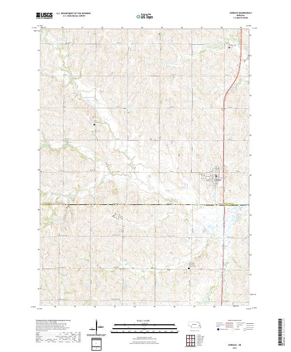
2021 Map of Ceresco
USGS Topo · Published 2021About this map
Ceresco serves as the primary hub of this eastern Nebraska landscape, situated near the boundary where Saunders Co and Lancaster Co meet. The area is defined by a dense network of watercourses and small reservoirs, including Palm Reservoir and Marshalek Reservoir, which support the surrounding agricultural tracts. Historically significant sites are preserved through the inclusion of several local burial grounds, such as Fridhem Cem, Rock Creek Cem, and Saint Mary and Saint Patrick Cem. These landmarks, along with established drainage systems like N Fork Rock Cr and Ash Hollow Cr, illustrate a rural community where land use is intimately tied to the local hydrology. The road network, characterized by routes like Ashland Rd and Agnew Rd, connects these scattered homesteads and communal sites, reflecting the enduring grid-based settlement pattern of the region.
Find a feature on this map
32 named features on this map. Tap any name to fly to it.
Don’t see what you’re looking for? This feature index may not catch every label — zoom into the map to look around manually.
Map Details
Editions of this 2021 Ceresco Map
This is the sole edition of this map. No revisions or reprints were ever made.
Other maps of this area

1897 · Lincoln
USGS Topo · 1:125,000

1899 · Wahoo
USGS Topo · 1:125,000

1955 · Fremont
USGS Topo · 1:250,000

1955 · Lincoln
USGS Topo · 1:250,000

1957 · Fremont
USGS Topo · 1:250,000

1957 · Lincoln
USGS Topo · 1:250,000

1958 · Fremont
USGS Topo · 1:250,000

1958 · Lincoln
USGS Topo · 1:250,000

1964 · Waverly
USGS Topo · 1:24,000

1964 · Davey
USGS Topo · 1:24,000