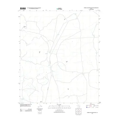
2013 Map of Cerro Alto Mountain
USGS Topo · Published 2013About this map
Cerro Alto Mtn and Naville Mtn dominate this arid landscape in El Paso County, where water management is the primary marker of human activity. The terrain is defined by a network of ranching infrastructure, specifically numerous named tanks used for catchment and livestock, such as Lincoln Tank, Jim Tank, and Tank Number One. These features, along with Dugout Tank in the southwest corner, suggest a landscape adapted for cattle ranching in a desert environment.
Find a feature on this map
18 named features on this map. Tap any name to fly to it.
Don’t see what you’re looking for? This feature index may not catch every label — zoom into the map to look around manually.
Map Details
Editions of this 2013 Cerro Alto Mountain Map
This is the sole edition of this map. No revisions or reprints were ever made.
Other maps of this area

1896 · El Paso
USGS Topo · 1:125,000

1903 · Cerro Alto
USGS Topo · 1:125,000

1908 · El Paso
USGS Topo · 1:125,000

1939 · Heuco Tanks
USGS Topo · 1:62,500

1940 · Heuco Tanks
USGS Topo · 1:62,500

1940 · Bassett Lake
USGS Topo · 1:62,500

1941 · Heuco Mountains
USGS Topo · 1:62,500

1941 · Desert
USGS Topo · 1:62,500

1943 · Desert
USGS Topo · 1:62,500

1943 · Heuco Mountains
USGS Topo · 1:62,500